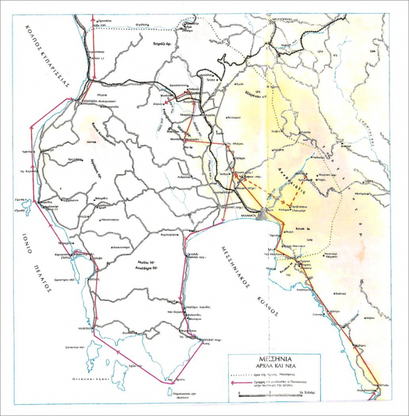
Ancient Thouria as a perioikos polis played a very important role in Messenia, as it was the most significant city of western Messenia and, after 369 B.C. when Messene was founded, the second in power city after Messene. For this reason, the sea area from the regions of Avia and Phares up to the outfalls of Pamisos River was called “Thouriates gulf”. (FIG. 1 – Map of Messenia)
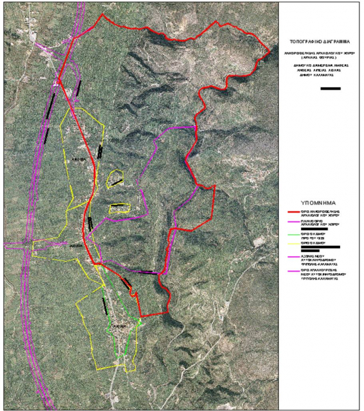
The ruins of the ancient city are located on an elongated ridge, with direction N-S, located approximately 10km northwest of the city of Kalamata, on the right side of the Kalamata-Tripolis motorway, to the north (approximately 2,5km) of the modern town of Thouria. (FIG. 2- Aerial Photo)
The site has been identified by epigraphic finds that mention the name of the ancient city, while according to Pausanias (4.31.1-2) who has given a brief description of Thouria, this was the location of Homeric Antheia. On the other hand, Strabo identified the city with Homeric Aepeia from the ancient Greek word αιπύς that means tall or steep, as the city of Thouria was built on a high hill. It is characteristic, however, that two modern neighboring settlements that are located at the western foot of the hill are named Antheia and Aepeia respectively.
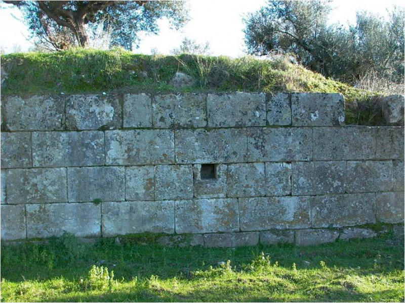
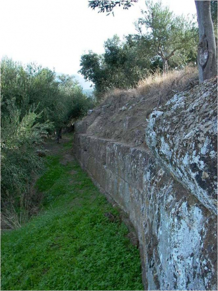
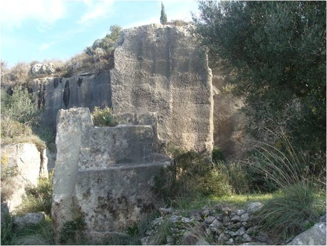
At the northern end of the hill, where the ancient acropolis is located, there is a visible part of the ancient fortification walls with rectangular fortification towers that are dated to the 4th century BC, built with care according to the isodomic system. (FIG. 3, 4, 5, 6)
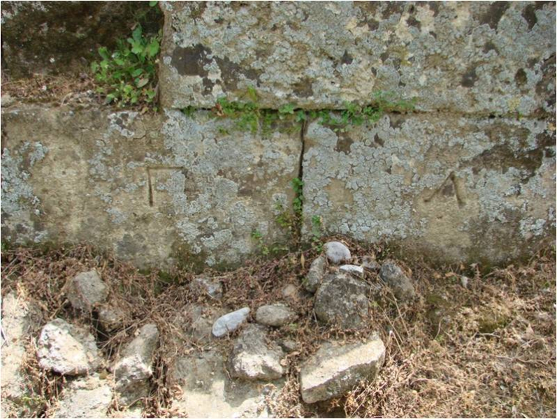
Of particular interest are the tectonic signs that are clearly seen, inscribed on the surface of the blocks of the fortification walls. (FIG. 7)
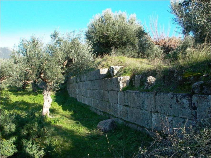
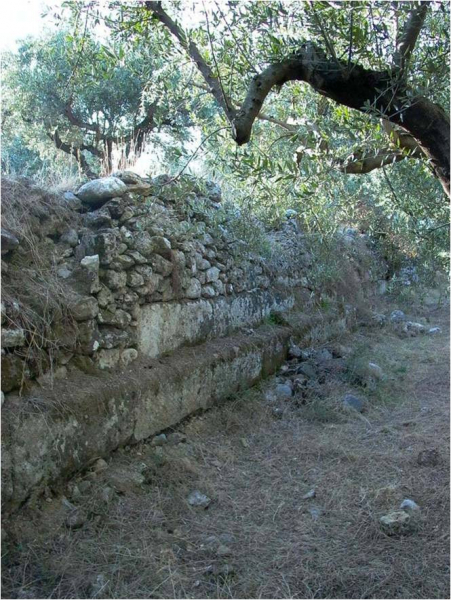
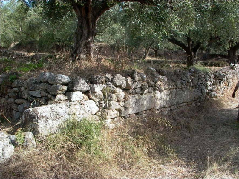
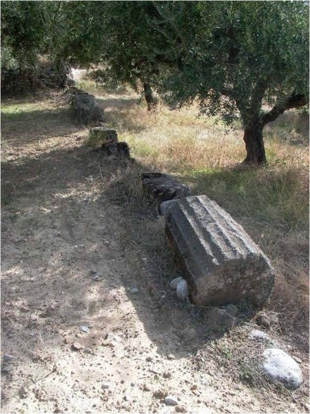
On the southern side of the ridge, there are parts of walls or individual blocks in secondary use and built into the modern supporting walls for agriculture, (FIG. 8), as well as scattered parts of fluted columns. (FIG.9)
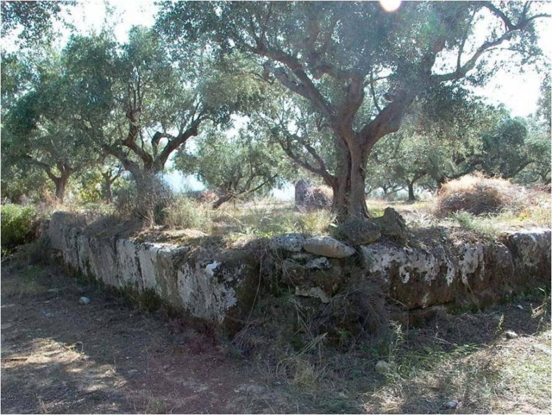
Parts of fortification walls and buildings are located on the eastern and also on the western part of the acropolis, while in the southern plateau the foundations of a large building are visible, possibly of a temple, with one column preserved in situ. (FIG. 10)
The city had possibly a Theater and a Gymnasium, while a large rectangular water cistern is visible on the western side, below the acropolis.
The ancient limestone quarry used for the construction of buildings for the ancient city has been identified 1km north of Thouria, in a position known as “Prionista”. (FIG. 11)
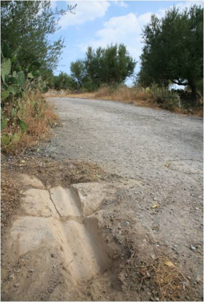
In some parts the traces of an ancient road are also visible through which the building material was transported from the quarry to the city. (FIG. 12)
The extremely impressive large number of scattered ceramics in a large extending area, as well as of the stone architectural material indicate the size of the ancient city that has suffered great destruction, at least during the last 100 years due to intensive cultivation of the rich soil, a fact that had as a result the altering of the morphology of the area.
The wonderful location of Thouria that dominates across the fertile plain of Kalamata, offering a unique view, with the Mountain of Ithome to the northwest and the sea to the south, was already inhabited since the prehistoric period. (FIG. 13)
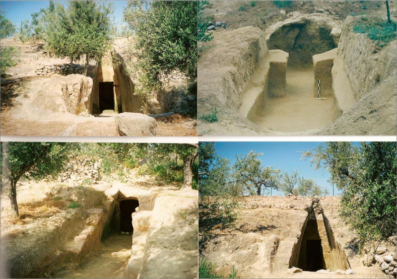
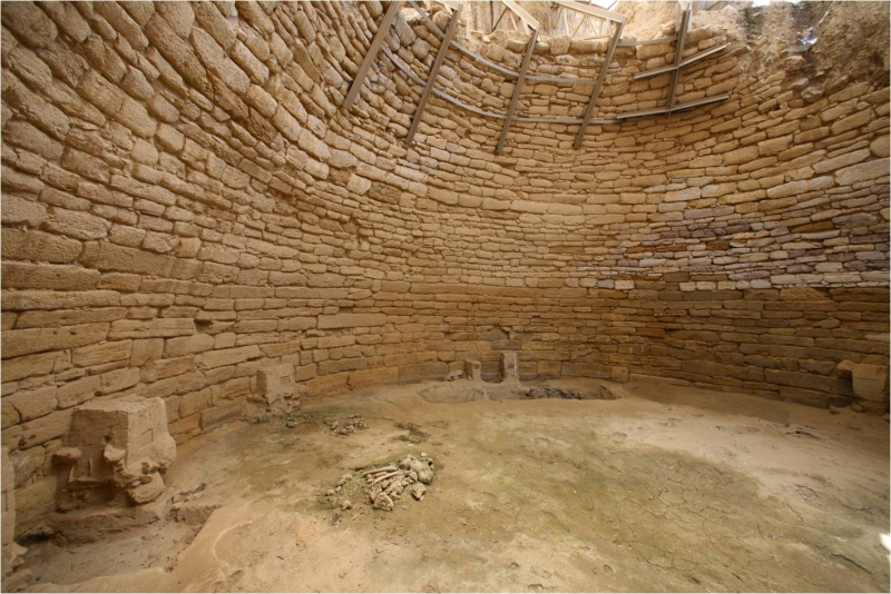
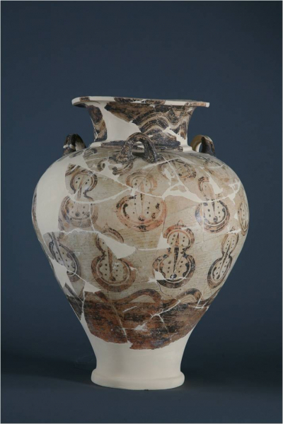
Clear remains of habitation of the early Helladic and late Helladic periods have been identified on the three low tops that are formed on the southern end of the ridge, at the site called “Hellenica”, where part of a large Mycenaean necropolis has been excavated consisting of 16 chamber tombs, (FIG. 14), while to the north, near the village of modern Antheia, a large tholos royal tomb with rich offerings has come to light. (FIG. 15, 16, 17)


